Tuesday 18th
February 2020
After a visit first thing, to Venetian Chandlery, and a chat with
Susan, we moved off. Rain was forecast for the afternoon and we had, for us at
this time of year, a busy day ahead.
Barbridge Junction, just 1½ miles away, brought us to the end of
our slow transit, exploring the Middlewich Branch. The 10 miles and 4 locks
from Middlewich, had taken us 10 days. Although weather was a factor, we had
thoroughly enjoyed it and had stopped in a number of places we had not
previously visited.
At Barbridge the Middlewich Branch joins the main line of what is now
known as the Shropshire Union Canal. However, the Shroppie, as it is commonly known,
has a complex history and, originally, the section between Chester and Barbridge
was built as the Chester Canal between 1772 and 1779. As originally planned,
this canal was to connect the port of Chester with the Trent and Mersey Canal
at Middlewich, with a short branch leading to Nantwich.
The building of the Trent and Mersey was the cause for this new
venture as it was seen as a threat to Chester as a seaport and the River Dee
Navigation. The canal was designed to bolster Chester as an alternative port to
Liverpool.
Chester had been the major port in the North West of England until the
emergence of Liverpool in the 18th
century, coinciding with silting of the River Dee, brought about its demise.
Sea ports on the River Dee then started to move down river to Neston and
Parkgate, before the importance of Liverpool overtook them.
Due to engineering and financial difficulties, the main line was of
the Chester Canal was altered to terminate at a basin and warehouses outside
Nantwich, with the line to Middlewich demoted be a branch. The Nantwich –
Chester line was completed in 1779 but the spur to Middlewich was not realised
until 54 years later.
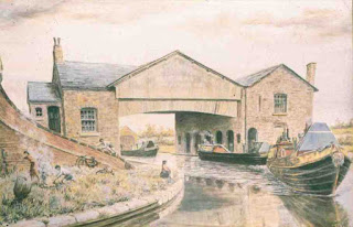
Barbridge Junction, Past and Present
We stopped briefly at Barbridge for a look around and to see the
ongoing works at the culvert just off the Nantwich side of the junction that
has caused the stoppage. On close inspection, the outlines of the wharf
buildings that used be located at the canal terminus can just be seen, although
there is no trace of them today.
The Chester Canal was built as an early contour canal, following the
lay of the land. Due to the canal not connecting with the T&M, it only
serviced a very local, rural area and was wholly uneconomic. The company resolved to abandon the canal in 1781. However, they managed
to keep going somehow, until construction of the Ellesmere Canal began. The
Chester Canal then became part of a much larger network servicing much of North
Wales, which generated more traffic, and the two companies amalgamated in 1813,
to become the Ellesmere and Chester Canal.
We
turned right at the junction, heading towards Chester on what was originally
the Chester Canal. Passing the huge North Western Farmers warehouses, we
reached Calveley where we stopped at the service station, located in an old
warehouse building complete with canopy, for a long overdue rubbish dump and
toilet emptying. Beyond Calveley, we passed some well-hidden lime kilns beside
the canal on the short trip to Bunbury, where we expected to moor until the
opening of Tilstone Lock on Friday 21st.
Calveley Service
Station
However,
the side of the canal was so shallow, we could get no closer than 18” to the
bank, which was again, very muddy. Once moored we walked beyond Bunbury Locks
and decided mooring here would be far better and so back to the boat and we
moved, descending Bunbury Staircase Locks.
Bunbury
is an impressive canal site with its wharf building, stables, staircase locks
and lockkeepers cottage.
Bunbury
Staircase Locks and Wharf
We
descending a staircase lock, it is necessary to have the top chamber full and
any subsequent chambers emptied, which actually leaves them half full. The boat
then enters the top chamber which is then emptied into the next chamber,
equalising the levels and so on until the lower level is reached. This means
that descending the locks, no matter how many in the staircase, only uses one
chamber full of water. People often get this procedure wrong and have all the
chambers full such that, emptying one into the other causes the lower chamber
to overflow, flooding the adjacent bank. At Bunbury the brickwork in the lock
wall has slits that remove any excess water from the chamber into the sluice
alongside.
Trying
to moor turned out a right carry-on. Firstly, where we had wanted to stop, was
too shallow.
Brenda with her depth gauge
Brenda
then walked further down with a depth gauge and decided it was better further
down, so we moved again and managed to get the boat alongside. However, by the
time we put the stakes in, the boat had moved out from the bank and, within an
hour, had developed a 10˚ list. We are in the short ½ mile pound between
Bunbury and Tilstone Locks with Tilstone closed. CRT are also working on
Beeston Locks further down the canal and do not want any water running beyond
Tilstone, and so have sluices open lowering the pound we are sitting in.
While
it is not ideal and very disconcerting and uncomfortable, living with floors
that slope 10˚, we have decided to put up with it until the locks open on
Friday.
Weather:
cold but clear.
Day Total: 2 locks; 5 miles; 0 Tunnels; 0 Swing Bridges; 0 Lift
Bridges; 0 Boat Lift; Day’s running hours 3.6
Overall Total: 875 locks; 1531 miles; 53 tunnels; 61 Swing Bridges; 17
Lift Bridges; 2 Boat Lifts; total engine running hours 1025.7


Comments
Post a Comment